How Compact Satellite Weather Receivers Paired With Trail Navigation Apps Are Changing Risk Planning for Travelers in Remote Mountain and Coastal Regions
Marcus Chen
10/06/2026
6 min read
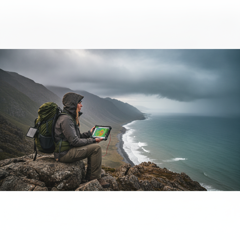
Remote wilderness travel has always carried an unspoken contract: the farther you go from cell towers and paved roads, the more you depend on preparation rather than rescue. That contract is being rewritten by a generation of compact satellite weather receivers that pair seamlessly with trail navigation apps, giving travelers in mountain ranges and coastal backcountry access to the kind of real-time atmospheric data that search-and-rescue professionals once envied. The shift isn't just technological — it's cultural, changing how experienced hikers, kayakers, and offshore sailors think about acceptable risk before they ever leave the trailhead.
What Has Changed in How Travelers Assess Weather Risk?
For decades, remote travelers relied on printed forecasts, barometers, and sky-reading instincts developed over years of field experience. These methods worked well enough in stable climates, but mountain weather and coastal systems routinely outpace general forecasts by hours. A regional forecast issued at dawn can be dangerously stale by early afternoon in high alpine terrain, where localized convective storms build faster than any fixed-schedule broadcast can track. The problem wasn't a lack of concern about weather — it was a structural gap between the granularity of available data and the speed at which conditions change in technical terrain.
Compact satellite weather receivers close that gap by pulling real-time updates directly from weather satellites, bypassing cellular infrastructure entirely. Devices like the Garmin inReach Mini 2 now integrate weather overlays that update on short cycles, delivering wind speed, precipitation probability, and pressure trend data to a unit that fits inside a jacket pocket. Paired with apps like Gaia GPS or Caltopo, that data becomes spatially contextual — meaning a traveler can see incoming weather relative to their exact position on a topographic map rather than interpreting a generic regional bulletin.
How Do Trail Navigation Apps Add Value Beyond Mapping?
Navigation apps have matured well beyond their original purpose of replacing paper maps. Platforms like Gaia GPS now layer weather radar, satellite imagery, and terrain analysis tools onto the same interface used for route planning, creating a unified risk picture that was previously scattered across multiple information sources. When you're above treeline on an exposed ridge and a storm cell is building to the west, seeing that pressure drop overlaid directly on your planned descent route changes the decision-making calculus in a concrete, immediate way.
Caltopo, which has a strong following among backcountry skiers, coastal paddlers, and technical hikers, offers slope angle shading alongside weather integration — a feature that becomes critical when assessing avalanche exposure in real time. These layered tools encourage a more deliberate kind of planning, where route adjustments happen before conditions deteriorate rather than in response to them. The practical outcome is that travelers who use these paired systems tend to make earlier turn-around decisions, a behavioral shift that risk experts consider among the most valuable outcomes of the technology.
When Does the Satellite Connection Matter Most?
The timing of when you check your satellite receiver is as important as owning one. Weather windows in alpine terrain tend to be most reliable in the early morning hours, and the pattern of pressure changes observed on a satellite receiver between dawn and mid-morning often predicts afternoon stability more accurately than any forecast issued the previous evening. Coastal travelers planning open-water crossings in sea kayaks or small sailboats benefit from checking updated wind and swell data within two hours of departure, when the most recent satellite pass has refreshed the local atmospheric picture.
For multi-day wilderness trips planned around summer thunderstorm season — which in the Rocky Mountains typically runs from late June through early September — daily check-ins with a device like the Garmin inReach Mini 2 allow travelers to reconsider high-exposure terrain on days when convective development is expected to be aggressive. The discipline of building weather reviews into the daily camp routine, rather than treating forecasts as a pre-trip formality, is one of the more practical habits that experienced remote travelers have adopted as these tools have become mainstream.
How Are Coastal Travelers Using These Systems Differently?
Mountain travelers deal primarily with rapidly developing local storms, but coastal users face a different set of variables: sustained wind patterns, swell intervals, tidal windows, and offshore fog. For sea kayakers crossing exposed headlands along the Pacific Coast or planning island-to-island routes in places like the San Juan Islands or Haida Gwaii, the combination of satellite weather data and apps like PredictWind creates a planning layer that accounts for both macro synoptic conditions and the hyper-local effect of coastal geography on wind behavior. These tools don't replace seamanship judgment — they inform it with a precision that paper charts and VHF weather broadcasts alone cannot match.
PredictWind, which has built a loyal following among offshore sailors and coastal expedition paddlers, offers offshore forecast models that extend further from shore than standard marine weather services, making it particularly relevant for travelers planning crossings in regions where coastal infrastructure is sparse. When combined with a two-way satellite communicator, the system also gives shore contacts real-time position updates, collapsing the gap between solo wilderness travel and the kind of monitored expedition travel that once required dedicated support teams.
What Should You Do Before Your Next Remote Trip?
The pre-season window before a major remote trip is the best time to test these systems together rather than learning their quirks in the field. Charging and updating firmware on a satellite receiver, syncing it with your preferred navigation app, and running through a mock weather-check routine at home ensures you understand the interface before your judgment is taxed by altitude, fatigue, or rapidly changing conditions. Renting a satellite communicator before committing to a purchase is also a practical step — most dedicated outdoor retailers and some gear libraries offer short-term rental programs that let you evaluate real-world usability on a lower-stakes outing first.
The travelers who get the most value from these paired systems aren't necessarily the most tech-savvy — they're the ones who treat weather data as a living input to their decision-making rather than a pre-departure checkbox. That mindset, more than the hardware itself, is what the technology is gradually teaching.
The same instinct that once made experienced wilderness travelers carry a barometer and read cloud formations at dusk is alive in the modern satellite receiver — it's simply been given better data to work with. The mountain and the ocean haven't changed, but the quality of information available to the people moving through them has improved in ways that matter precisely when conditions deteriorate and the cost of a poor decision is highest. Start planning your next remote trip now, and build the weather review habit into the itinerary from the beginning.
More Trending Articles
How Supermarket Deli Counter Pricing Compares to Pre-Packaged Equivalents and Which Categories Consistently Offer Better Value When You Buy by Weight
Jennifer Walsh
10/27/2026